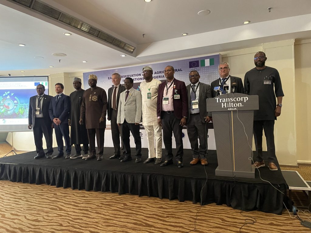
The Federal Government, in partnership with the European Union (EU), has launched a £2.7 million Earth Observation (EO)-based agricultural innovation project aimed at modernising Nigeria’s agriculture sector through satellite technology, artificial intelligence, and data-driven systems.
The initiative is being implemented by the National Space Research and Development Agency (NASRDA) in collaboration with the European Space Agency (ESA), and is designed to strengthen climate-smart agriculture, improve productivity, and enhance national food security.
Agriculture at the Centre of Nigeria’s Economic Reform
Speaking at the inauguration in Abuja, the Minister of Science, Technology and Innovation described the project as a major milestone in Nigeria’s agricultural transformation.
He noted that agriculture remains a core pillar of the economy but continues to face growing pressure from climate change, land degradation, environmental stress, and rapid population growth.
He explained that addressing these challenges requires a shift away from traditional practices toward innovation-driven and data-supported farming systems, aligned with the government’s broader food security agenda.
Commodity.ng Insight
This project signals a shift in Nigeria’s agricultural strategy from reactive farming to predictive agriculture. By integrating satellite and AI systems, decision-making in agriculture can move from guesswork to real-time data intelligence, potentially reducing crop failure risks and improving national planning for food supply.
Space Technology for Real-World Farming Solutions
According to the Director-General of NASRDA, Nigeria has invested heavily in satellite infrastructure, data systems, and technical capacity over the years. However, the real impact of space technology lies in converting raw data into practical agricultural solutions.
He explained that Earth Observation tools can support:
- Crop monitoring and forecasting
- Climate and environmental risk assessment
- Land use planning
- Evidence-based agricultural decision-making
He added that the initiative aligns with global Sustainable Development Goals (SDGs) and reflects growing African–European scientific collaboration.
Commodity.ng Insight
The key value of this project is not satellite deployment itself, but data accessibility at farm level. If successfully implemented, it could bridge Nigeria’s long-standing gap between high-level research institutions and everyday farmers who often lack actionable agricultural intelligence.
EU Backing and Global Partnership Strategy
The EU Ambassador to Nigeria confirmed that the project, funded under the EU Global Gateway strategy, will run for three years and support both farmers and herders with space-based agricultural intelligence.
He stated that the initiative will:
- Promote climate-smart agricultural practices
- Improve livestock management systems
- Modernise farming operations through digital tools
He also noted that Nigeria was selected due to its growing technological capacity and potential to become a regional hub for agricultural innovation in Africa.
Satellite Data for Smarter Agriculture
The Minister of Agriculture and Food Security highlighted the importance of satellite imagery in modern agriculture, particularly for:
- Soil mapping
- Crop yield forecasting
- Land use optimisation
- Resource allocation planning
These tools are expected to improve efficiency across Nigeria’s agricultural value chain.
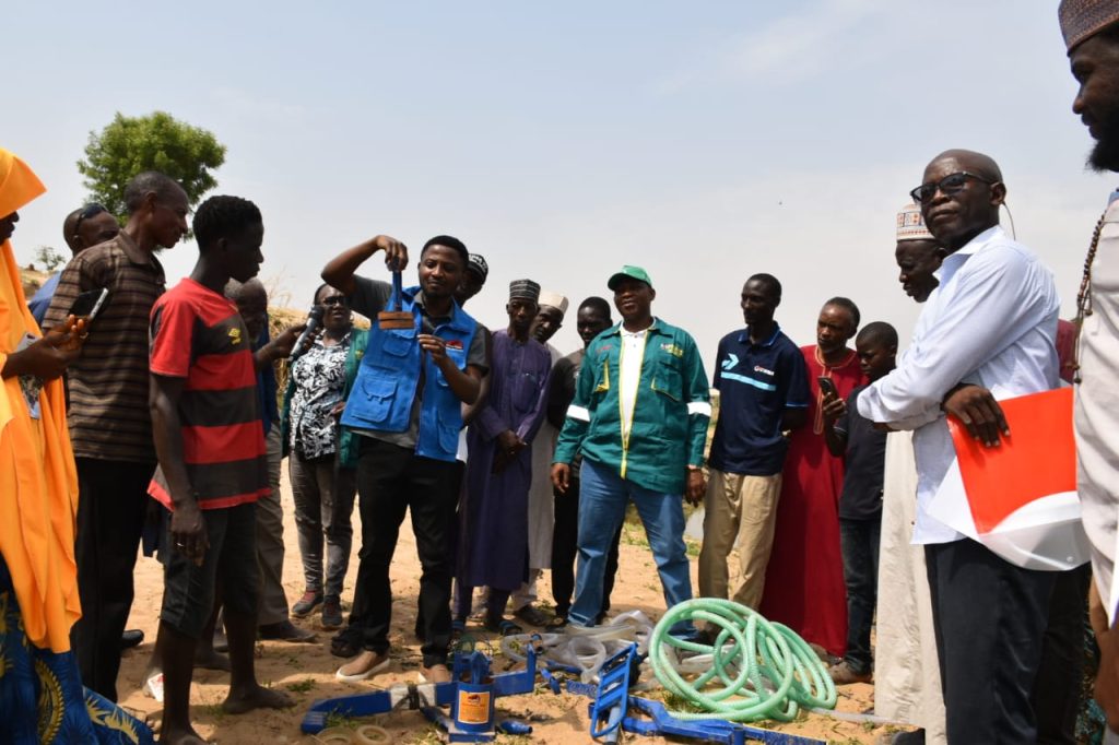
Pilot States and Digital Farming Tools
Seven states have been selected for pilot implementation across Nigeria’s agro-ecological zones. These include Kano, Bauchi, Plateau, Oyo, Enugu, Cross River, and the Federal Capital Territory (FCT).
Farmers in these locations will be equipped with:
- Internet of Things (IoT) devices
- AI-based agricultural advisory tools
- Digital data collection systems
Commodity.ng Insight
The selection of diverse agro-ecological zones is critical because it allows the system to generate region-specific agricultural intelligence. If properly scaled, this could create Nigeria’s first structured national agricultural dataset capable of guiding policy, pricing, and production planning.
Open-Source Agricultural Intelligence System
Project experts revealed that a key component of the initiative is the development of a sustainable open-source agricultural information system co-designed with NASRDA.
The platform will integrate:
- Satellite data
- Ground sensors
- AI-powered advisory systems
- SMS alerts for farmers
- Voice-based agricultural guidance tools
- Mobile and web dashboards
This is aimed at ensuring farmers receive real-time, easy-to-understand information regardless of literacy levels or location.
Conclusion
The £2.7 million Earth Observation agricultural project represents a major step toward digitising Nigeria’s farming system. By combining satellite technology, AI tools, and on-ground data collection, the initiative aims to improve productivity, climate resilience, and food security.
However, its long-term impact will depend on how effectively advanced data systems are translated into practical, affordable tools for smallholder farmers, who form the backbone of Nigeria’s agricultural sector.